


mbu FY2018 Annual Report Figure 1

Figure 1:
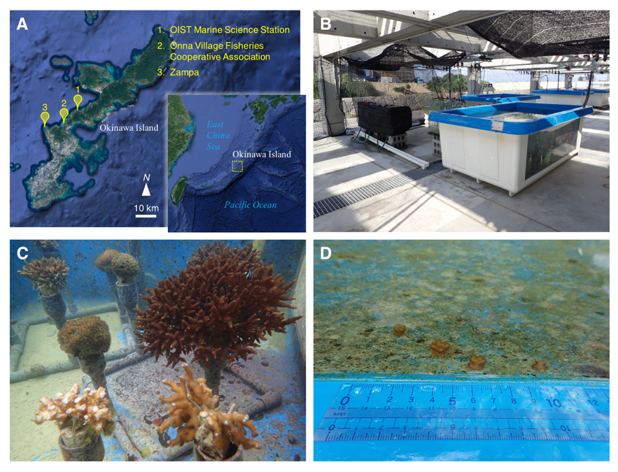
Location, outdoor tank, and coral colonies. (A) A map of the Nansei Islands and the location of the OIST Marine Science Station, Onna Village Fisheries Cooperative Association, and Zampa in Okinawa Island. Original maps were downloaded from Google Earth. Map data: Google Earth, Image Land- sat/Copernicus, Data SIO, NOAA, US Navy, NGA, GEBCO. (B, C) Coral colonies maintained under natural sea water flow in the outdoor tank. (D) Small colonies were discovered in the tank on January, 2018. These photographs in B, C, and D were taken by Yuichi Nakajima.
Date:
07 March 2024
Copyright OIST (Okinawa Institute of Science and Technology Graduate University, 沖縄科学技術大学院大学). Creative Commons Attribution 4.0 International License (CC BY 4.0).
Share on:


