Column: From the Earth’s core to Okinawa’s coastline
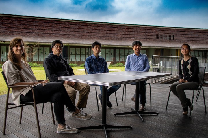
The latest OIST column in the Asahi Shimbun GLOBE+ is out now! OIST science writer, Lucy Dickie, spoke to Professor Emile Touber and Professor Satoshi Mitarai about their work tracking the pumice around Okinawa. The article is in Japanese, but the original English version can be read below.
From the Earth’s core to Okinawa’s coastline
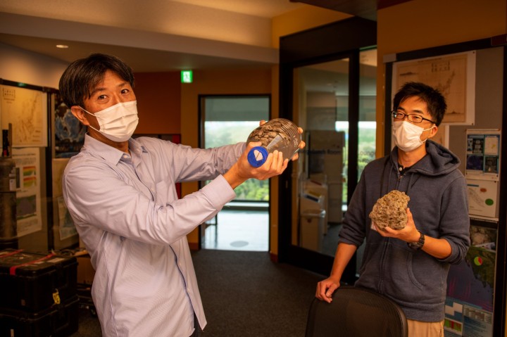
In mid-October 2021, Prof. Emile Touber, a French fluid dynamics researcher at the Okinawa Institute of Science and Technology Graduate University (OIST) took a flight from Tokyo to Naha. As the plane neared its destination, Emile looked down at the subtropical island of Okinawa below and noticed something unusual. Surrounding the coastline were clumps of black material that drifted around the many bays and capes. Emile explained how he originally thought that these dark slicks were the result of a coral spawning event.
“As a fluid dynamics researcher, I’m really interested in slicks that appear on the ocean surface,” he explained, when I caught up with him in December 2021. “Although I didn’t even know what the material was, I wanted to find out how it would move on the surface and where it would go.”
After landing at Naha airport, Emile contacted Prof. Satoshi Mitarai, an oceanographer at OIST, to ask if he’d noticed the mass coral spawning.
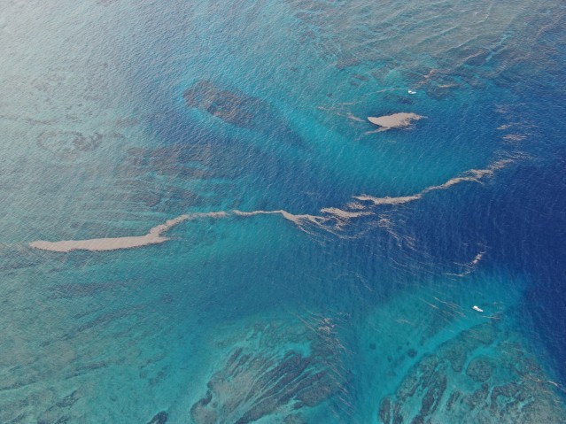
But it wasn’t a coral spawning. It was something far rarer. On August 13th, 2021, a submarine volcano in the Ogasawara Island chain had exploded. It might have gone unnoticed, if it hadn’t been for the tens of millions of cubic meters of pumice that was blasted into the surrounding ocean, and the combination of seasonal winds and currents that saw massive amounts of this pumice end up on Okinawa’s doorstep.
As Emile would later say, this event was a natural experiment, a way to test his fluid dynamics simulations in a way that would have been impossible to replicate in the laboratory.
***
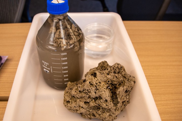
Pumice is formed when hot, pressurized rock is suddenly ejected into an environment that causes it to rapidly cool and depressurize. The fast change in temperature and pressure results in bubbles of air forming in the rock, creating a porous material. As such, it’s very light and will float on water. Pumice rafts are a common feature of submarine volcanic eruptions. In fact, in remote corners of the Pacific ring of fire, the violent eruptions themselves might go unnoticed, with only the rafts of pumice that are spotted weeks to months later revealing the event.
On October 4th, the stones started to arrive on the shores of Kitadaitōjima and Minamidaitōjima—small islands to the east of Okinawa. Seven days later, they were reported around Amami Ōshima. Then, on October 13th, Okinawa confirmed the arrival of the stones. And the following weeks saw huge pumice rafts arrive around the island. In certain areas, it congregated in ports, and caused disruptions to the fishing and tourism industries, by damaging the engines of boats. The questions that played on everyone’s mind were how long it would be around, and what would happen to it. So, Emile and Satoshi teamed up to find out.
***
The mighty Kuroshio Current is one of the world’s major currents. It forms the western lane of the North Pacific Subtropical Gyre, driving warm water from the Philippines to the coasts of Japan and China. It might seem logical to think that the pumice will eventually be caught in this current and taken from Okinawa, northward to mainland Japan… but Satoshi doesn’t think that this will be the case. Rather, he thinks that a lesser known current probably has more of a hand in the pumice’s current distribution, and its future path.
“Yes, there’s the Kuroshio Current driving water north,” explained Satoshi. “But few people realize that there’s a weaker, but prevalent Kuroshio Countercurrent that flows in the opposite direction.”
In 2012, Satoshi conducted an experiment with a series of GPS-tagged buoys off Okinawa. The buoys moved in small circles for a number of months and most of them eventually washed up on Okinawa’s beaches, but none of them ended up around the mainland.
Another theory that Satoshi doesn’t think stands up is the idea that late summer typhoons around Okinawa had a hand in bringing the pumice to the prefecture. In 2012, a typhoon did pass through the group of buoys. Its presence was felt, causing the buoys to move in larger circles than they previously had for a while, but it didn’t seem to influence their overall path. If anything, both Emile and Satoshi agree that the typhoons probably helped break apart the pumice stones.
So, what brought the pumice to Okinawa this time round? It seems that it was all about timing.
The volcano erupted in August, as monsoon winds in the South China Sea were raging. These strong, seasonal winds first drove the pumice northwest, where the massive rafts met the Kuroshio Countercurrent and the prevalent trade winds. This combination saw the pumice brought southwest to Okinawa’s shoreline. Then, as the months ticked by, the seasonal winter wind began, blowing from the north, which held the pumice firmly against Okinawa and the other islands in the prefecture.
Satoshi has two theories as to what will occur next. The pumice may remain against the coast until around June 2022, when the northern winter winds switch to the southern summer winds. But what he thinks is more likely to happen is that the pumice will break apart and sink before then.
“The wind, waves, solar radiation are all having their impact and it’s more probable that the pumice will break apart and sink before then,” Satoshi said. “The pumice began arriving in Taiwan in early December, but much smaller pieces are being reported, as can be expected.”
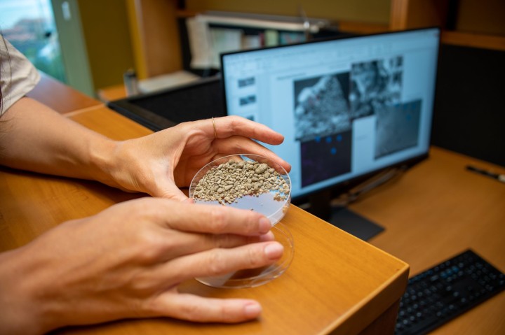
Emile and his team, which together make up OIST’s Shocks, Solitons and Turbulence Unit, look at the movement of the pumice rafts around Okinawa’s coastline. They were observing the sea surface for almost a year before the eruption to study surface slicks—patches of smooth-looking sea surfaces, in collaboration with Prof. Vincent Laudet. Vincent believes that the surface slicks have an important role to play in larvae survival. So, the biologist and the fluid dynamics researchers teamed up to investigate this theory further. What none of them had predicted was the eruption.
“Despite the fact that there are many people impacted from the pumice, as a researcher, it’s actually an amazing opportunity,” Emile said. “We’ve been directly observing the results of a natural phenomenon that can’t be planned. I’m not interested in the individual stones but rather being able to roughly estimate where the rafts will go due to the cocktail of different currents and winds.”
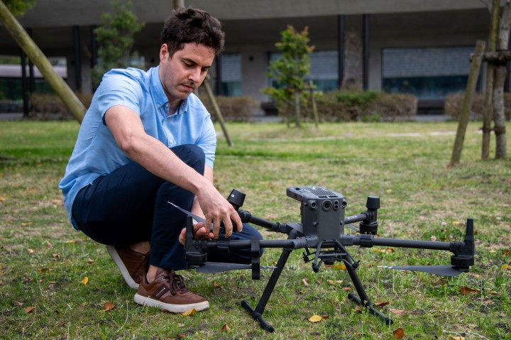
Armed with a webcam and a drone, Emile has been recording how pumice rafts travel across Tancha bay, which is located just in front of OIST. His Unit has captured images of how the pumice accumulates and then disperses around the area.
“The movement of pumice rafts are complex,” Emile explained, “as they’re influenced by trade winds, seasonal wind, tidal currents, and open sea currents. They fragment following the chaotic nature of atmospheric turbulence, making detailed predictions of their whereabouts challenging.”
Emile intends to use the footage to simulate, very roughly, the journey of patches of pumice rafts. He highlighted that the simulations will be an estimate, similar to forecasting the weather, as both systems suffer from random, unpredictable behavior.
From Japan to Tonga and beyond
What started as curios observations from a flight above Naha, now has the potential to stretch across the world. Both Emile and Satoshi realized this when, on January 15th, there was a massive eruption on Hunga Tonga–Hunga Haʻapai, an uninhabited volcanic island in the Polynesian archipelago of Tonga. The volcanic eruption, which initial data suggests is the largest since 1991, caused a shock wave to orbit the planet twice and saw unusual wave behavior in both the Pacific and the Atlantic. Emile quickly got to work, gathering observational data and producing simulations of the atmospheric and oceanic waves.
“Broadly speaking, it’s unlikely Okinawa will have another event like the results of the Fukutoku-Okanoba volcanic eruption for a very long time. But volcanic explosions and pumice washing up on islands are quite common occurrences around the world,” concluded Emile. “From this research, we can learn about the movement of pumice, the generation of tsunamis and the impact of atmospheric waves caused by these events. The research has universal implications.”