


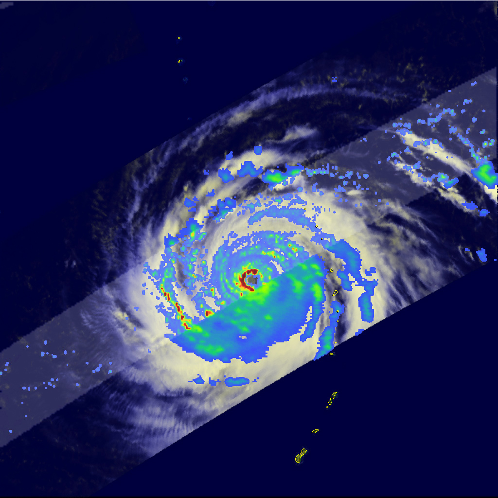
Typhoon Choi Wan captured by satellite as it passed through the Eastern Philippine Sea in September 2009.

Heaviness of rainfall around the typhoon’s center is marked by red, green and blue in that order. Areas with the heaviest rainfall, in red and green are around the central column.
Heaviness of rainfall around the typhoon’s center is marked by red, green and blue in that order. Areas with the heaviest rainfall, in red and green are around the central column. The Tropical Rainfall Measuring Mission (TRMM) satellite which captured the image is a joint mission between NASA and JAXA.
Image source: NASA Earth Observatory.
Date:
26 March 2015
Copyright OIST (Okinawa Institute of Science and Technology Graduate University, 沖縄科学技術大学院大学). Creative Commons Attribution 4.0 International License (CC BY 4.0).
Share on:


